STATE FORESTS OF NSW - Central West State Forest Map
Description
State Forests of NSW - Central West State Forest Map
Free Shipping Aust Wide!
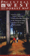
Central West State Forest Map
The Central West Forest Map covers the area west of the Blue Mountains, including the Central Tablelands, the Macquarie Valley, Bathurst, Orange and surrounds. The map shows all regularly maintained roads and trails, walking tracks, recreation areas and lookouts.
The reverse side contains photographs and commentary on the history of the regions' forests and forestry in the area, and details of recreation sites, including the must-see sites and a recreation facilities matrix.
This is a 'must have' for mountain bike riders, four-wheel-drive enthusiasts, bushwalkers, horseriders, dog owners and anyone who wants to explore the region's extensive public forest estate.
Specifications
| SKU | 1075 |
| Brand | Meridian Maps |
| Shipping Weight | 0.1000kg |
| Shipping Width | 0.210m |
| Shipping Height | 0.150m |
| Shipping Length | 0.010m |
Reviews
Be The First To Review This Product!
Help other motospares users shop smarter by writing reviews for products you have purchased.
More From This Category
$10.95
or 4 payments of $2.74 with
 Info
Info


